
It’s officially, finally, spring in Pittsburgh. There’s at least a 95% chance you won’t need your winter coat until next year, and every surface is coated with just a bit of mud. Now that the frost has broken, it’s the perfect time to get outside and shake off that seasonal affective disorder.
Pittsburgh not only has many great hiking trails within the city’s parks, but is located near a plethora of natural areas that are crisscrossed with trails. One of the most underrated benefits of hiking around Pittsburgh is the ability to explore weird, cool, and abandoned locations. The city has changed drastically over the years leaving old structures to return to nature in beautiful and interesting ways that make them perfect destinations for a sunny spring hike. Check out just a few of the most unique hiking destinations across the region.
Seldom Seen Greenway – Beechview
For adventurers looking to stay close to home, and their car, one of the most interesting hikes is within city limits. The abandoned train tunnel at the Seldom Seen Greenway is not far from its parking area — which is along Route 51, just along the turnoff for the Wabash Tunnel and Woodruff Street if you approach from the south — and is an easy hike for even tiny ‘burghers.
The hike out and back to the tunnel is just under a mile, and the 1902 brick arch train tunnel is truly a sight. Along Saw Mill Run, hikers will also find some great waterfalls and an abandoned bridge. The whole hike takes only about 30 minutes, making it a great introduction to exploring abandoned places.
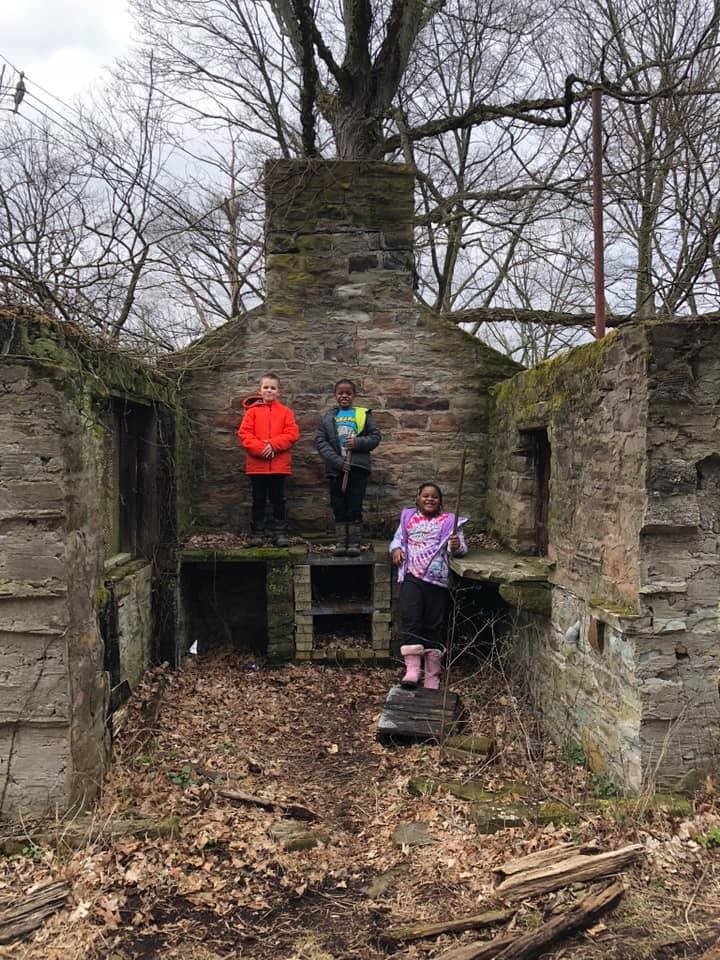
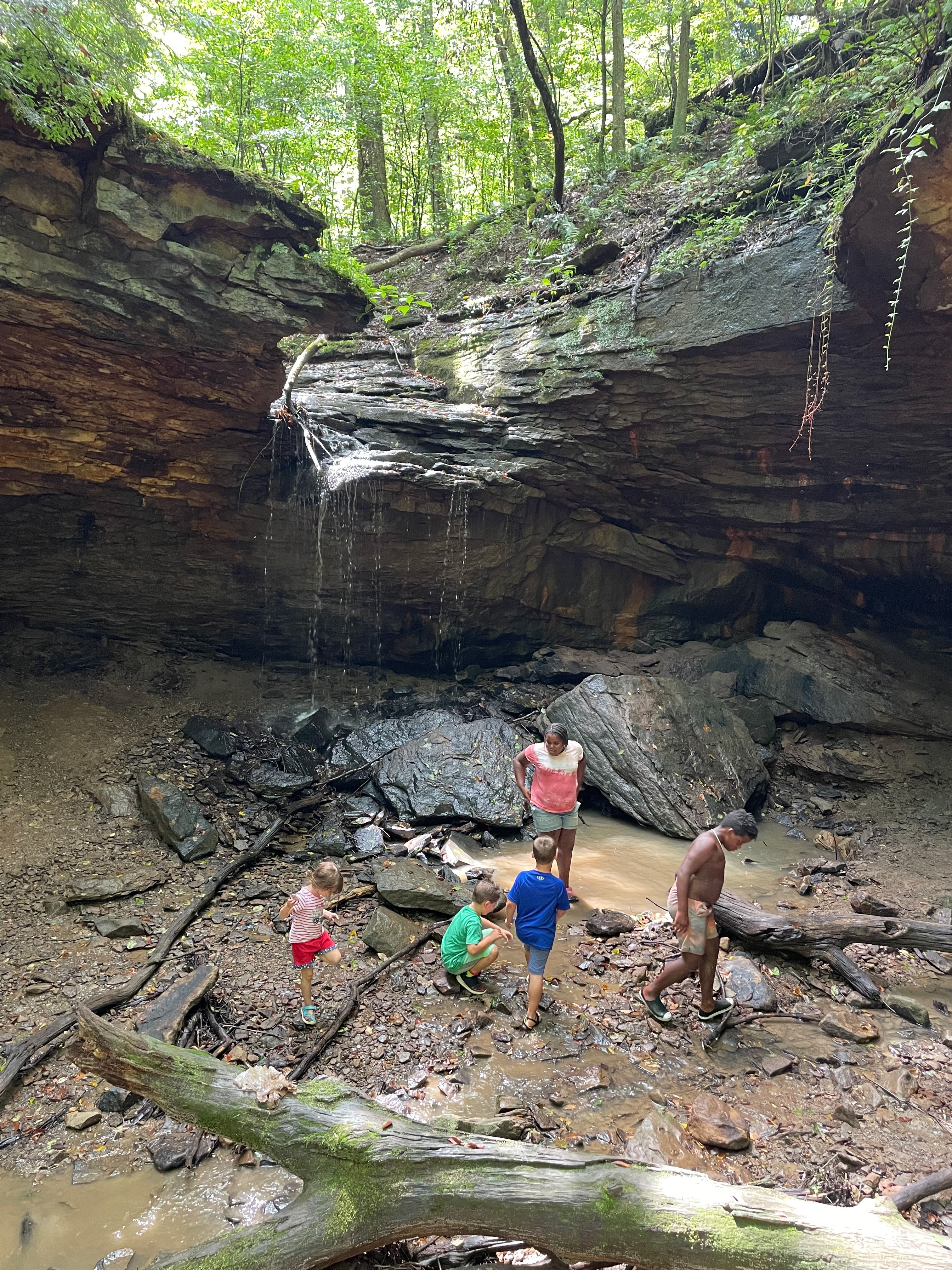
Abandoned Zoo and Stone Cabins — Riverview Park
Located in Pittsburgh’s North Side, Riverview Park is rife with abandoned places to explore. The land was donated to the city of Allegheny in 1894. When Allegheny was incorporated into Pittsburgh in 1907, it became a city park. The Allegheny Observatory, which opened in 1859, is one of the oldest structures in the park. It’s not abandoned, though — the telescope is still available for guided tours.
The old bear pit from the zoo is marked with signage along the path that runs from the playground to the pool, and it’s a perfect photo spot for a snarling selfie.
Deeper into the park, there are two abandoned cabins along Watson’s Trail. The original Watson Cabin, and a bathhouse built later, are available for cautious exploration. Most of what remains is the stone hearth and portions of the wall, as well as a few toilet stalls for gross photo opps. A bit harder to spot, the Wissahickon nature cabin was destroyed by arson years ago, but the stairs and parts of the foundation can be found along the Wissahickon Trail.

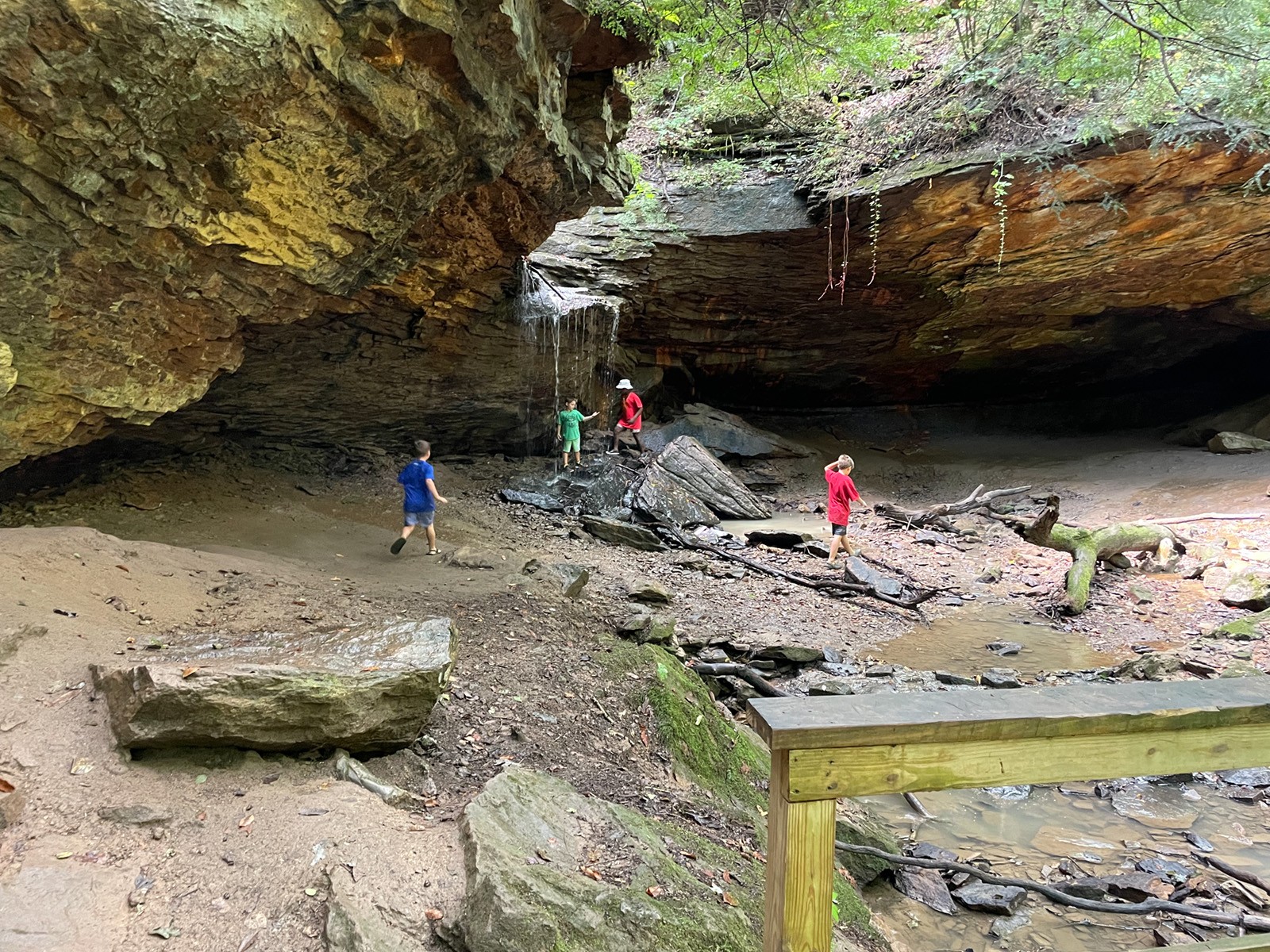
Dead Man’s Hollow — McKeesport
Is there a better name for an unusual hike than Dead Man’s Hollow? This portion of the Great Allegheny Passage trail, which runs from Pittsburgh to Cumberland, Md., is part of the Allegheny Land Trust. The site once housed a quarry and a pipe factory. While nature has pushed back against industry, curious hikers can spy remnants of what once was.
Enter the GAP by the baseball diamond and head south — the broken terra cotta pipes scattered about are the first sign you’re in the right place. On the map, look for the “industrial ruins” label. There are also guided tours of the area that talk about the history and danger of the area, including the reason it earned its name.
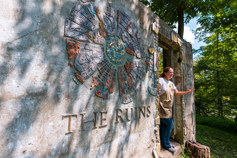
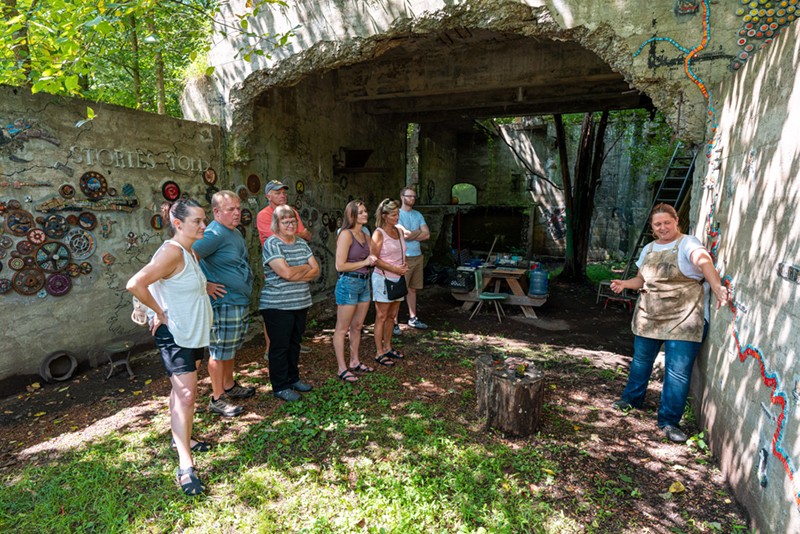
The Ruins Project — Perryopolis
This spot is unique in that it is abandoned, but lovingly curated. Local mosaic artist Rachel Sager operates her art studio along the Great Allegheny Passage trail in Fayette County. She also spearheads the The Ruins Project, an organic art installation in an abandoned Pittsburgh Coal Co. mine. Hundreds of artists have helped to decorate the old mine with art that reflects the history of the area. There’s even a 67-foot-long train mosaic. This stop is located at mile 104 of the GAP, which is the small coal town of Whitsett. Bike or hike to the spot for a tour of the mine.
Frankfort Mineral Springs — Raccoon Creek State Park
Before it became a gorgeous state park in Beaver County, Frankfort Mineral Springs was a destination for the area’s wealthy seeking a cure in the pristine water of the spring. Long since abandoned, the rubble of the resort is still visible along the top of the falls. A dip in the rejuvenating waters feels heavenly after a vigorous hike.
To find these falls, park at the Frankfort Mineral Springs Loop trailhead and follow the creek to the falls. The trail is mostly flat and easy to navigate for families with kids, but it’s not fit for a stroller or wagon. Due to its running along the stream, this trail is often muddy.
While you’re at Raccoon Creek, check out some of the ranger programs. They are free and provide a wealth of information about the ecological significance of the area.
The Fountain of Youth — North Park
Feeling a bit haggard after the long winter? Look no further than this abandoned spring in North Park. This spot doesn’t involve much hiking — it’s only a five-minute walk — but North Park is brimming with hiking trails that can easily fill an entire day. This ornate stone spring house no longer has a spigot, so don’t drink these healing waters. In fact, the spigot was removed in the ‘50s when the water became contaminated.
Located along Kummer Road, plugging the coordinates [40.599881, -80.021116] into any phone GPS will lead hikers right to the perfect parking spot. Be careful crossing the stream, as the steps are long-gone and the creek does not have a bridge.
Freedom Falls — Oil City
For a longer day trip (or perhaps a quick overnight stay in one of the many state parks or guest houses in and around the Allegheny National Forest), hikers can check out the abandoned iron furnace at Freedom Falls. There’s also the Rockland Tunnel, which was once used by the Allegheny Valley Railroad to traverse the route between Buffalo and Pittsburgh.
To start this hike, there is a parking area along Rockland Station Road. The parking area for this trail can be found at GPS coordinates [41.23703, -79.74797]. The Oil Region Alliance has some helpful information about finding this spot, which is a bit secluded.
Abandoned Turnpike Tunnels — Breezewood
Pittsburghers are no strangers to tunnel traffic. Believe it or not, it used to be much worse than it is. Did you know when the turnpike was first built, its tunnels were only one lane? This led to significant traffic backups as motor travel became popular. While some tunnels were widened, this 13-mile stretch of turnpike — which includes two tunnels — was abandoned. In 2001, it was donated by the Pennsylvania Turnpike Commission to the Southern Allegheny Conservancy. There are eventual plans to turn it into a bike path, but for now, the tunnels sit deliciously deserted.
By parking at Breezewood, it is a 30-minute hike along the old road surface to the Ray’s Hill Tunnel. It’s paved, so strollers work well for young kids. After traversing the first tunnel, it is about four miles to the Sideling Hill Tunnel. Both tunnels are very dark, so take a headlamp or flashlight.
Safety while hiking
When hitting the trail looking for old abandoned structures, exercise caution and remember that all hiking is at your own risk. Take a backup battery pack for your phone, share your location with a trusted loved one before heading out, and take water. While it may feel archaic, grabbing or printing a paper trail map is also a great backup in case your phone falls off a cliff or is otherwise incapacitated. Climbing abandoned structures that are not regularly maintained can be dangerous. We’ve included spots that are well-loved and generally safe as well as open to the public, but hikers should still be smart.
